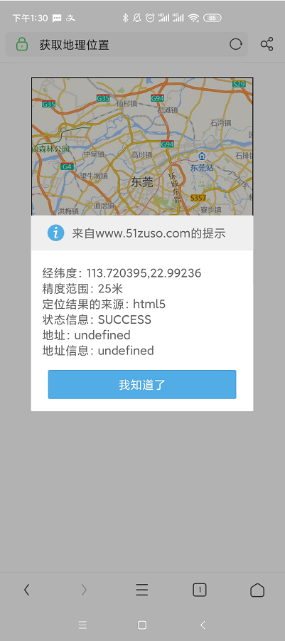
高德地图Geolocation permission denied
高德地图定位报错
{type: "error", message: "Geolocation permission denied.", info: "FAILED", status: 0}
百度一查有人说是需要https,试了一下,果然如此

deom
<!DOCTYPE html PUBLIC "-//W3C//DTD XHTML 1.0 Transitional//EN" "http://www.w3.org/TR/xhtml1/DTD/xhtml1-transitional.dtd">
<html xmlns="http://www.w3.org/1999/xhtml">
<head>
    <meta http-equiv="Content-Type" content="text/html; charset=utf-8" />
    <meta name="viewport" content="initial-scale=1.0, user-scalable=no">
    <title>获取地理位置</title>
    <style type="text/css">#iCenter{width:300px; height: 280px; border:1px #000 solid;margin:20px auto;}</style>
    <script type="text/javascript" src="http://webapi.amap.com/maps?v=1.4.3&key=3df877a70685dac5ecb3afa375d4c305"></script>
</head>
<body>

<div id="iCenter"></div>

<script type="text/javascript">
    var mapObj = new AMap.Map('iCenter');
    mapObj.plugin('AMap.Geolocation', function () {
        geolocation = new AMap.Geolocation({
            enableHighAccuracy: true, // 是否使用高精度定位,默认:true
            timeout: 10000,           // 超过10秒后停止定位,默认:无穷大
            maximumAge: 0,            // 定位结果缓存0毫秒,默认:0
            convert: true,            // 自动偏移坐标,偏移后的坐标为高德坐标,默认:true
            showButton: true,         // 显示定位按钮,默认:true
            buttonPosition: 'LB',     // 定位按钮停靠位置,默认:'LB',左下角
            buttonOffset: new AMap.Pixel(10, 20), // 定位按钮与设置的停靠位置的偏移量,默认:Pixel(10, 20)
            showMarker: true,         // 定位成功后在定位到的位置显示点标记,默认:true
            showCircle: true,         // 定位成功后用圆圈表示定位精度范围,默认:true
            panToLocation: true,      // 定位成功后将定位到的位置作为地图中心点,默认:true
            zoomToAccuracy:true       // 定位成功后调整地图视野范围使定位位置及精度范围视野内可见,默认:false
        });
        mapObj.addControl(geolocation);
        geolocation.getCurrentPosition();
        AMap.event.addListener(geolocation, 'complete', onComplete); // 返回定位信息
        AMap.event.addListener(geolocation, 'error', onError);       // 返回定位出错信息
    });

    function onComplete(obj){
        var res = '经纬度:' + obj.position +
                '\n精度范围:' + obj.accuracy +
                '米\n定位结果的来源:' + obj.location_type +
                '\n状态信息:' + obj.info +
                '\n地址:' + obj.formattedAddress +
                '\n地址信息:' + JSON.stringify(obj.addressComponent, null, 4);
        alert(res);
    }

    function onError(obj) {
        alert(obj.info + '--' + obj.message);
        console.log(obj);
    }
</script>
</body>
</html>
请问你是怎么使用https的